General Discussion
Related: Editorials & Other Articles, Issue Forums, Alliance Forums, Region Forums


 = new reply since forum marked as read
Highlight:
NoneDon't highlight anything
5 newestHighlight 5 most recent replies
= new reply since forum marked as read
Highlight:
NoneDon't highlight anything
5 newestHighlight 5 most recent replies

ThoughtCriminal
(14,199 posts)Anything over Cat-2 can be controlled with the right pen.
Only in the lunatic’s mind😀

EYESORE 9001
(27,199 posts)It’s gonna miss ya miss ya but it might just kiss ya 

malaise
(275,214 posts)😀

surfered
(1,924 posts)Click on region, then Western Tropical Atlantic
https://www.tropicaltidbits.com/analysis/models/?model=ecmwf®ion=watl&pkg=mslp_pcpn
malaise
(275,214 posts)1. Western Gulf of Mexico (AL91):
An area of low pressure has formed over the Bay of Campeche and is
producing disorganized showers and thunderstorms. The system is
forecast to drift slowly northward for a couple of days while it
interacts with a frontal boundary. Environmental conditions are
forecast to be conducive for development, and a tropical depression
is likely to form during the early or middle part of next week while
the system moves generally northward near or along the Mexican and
Texas Gulf coastline. Interests along the western Gulf of Mexico
coast should closely monitor the progress of this system.
* Formation chance through 48 hours...medium...50 percent.
* Formation chance through 7 days...high...70 percent.
2. Central Tropical Atlantic:
An area of low pressure over the central tropical Atlantic is
producing disorganized showers and thunderstorms. Gradual
development of this system is possible while the system meanders
during the next couple of days, and a tropical depression could form
early next week. The system is then forecast to move
west-northwestward at about 10 mph across the central tropical
Atlantic during the middle to latter part of next week.
* Formation chance through 48 hours...low...10 percent.
* Formation chance through 7 days...medium...40 percent.
And
Discussion from Mr Weatherman
https://www.youtube.com/channel/UC6Ov32gNPTKAa7-seHTl8Xw
malaise
(275,214 posts)

orthoclad
(4,227 posts)That's one factor to be concerned about. Also the "slow moving" part. That's how TX, LA get heavy floods.
Also a band of Atlantic hot water from Africa to S America. 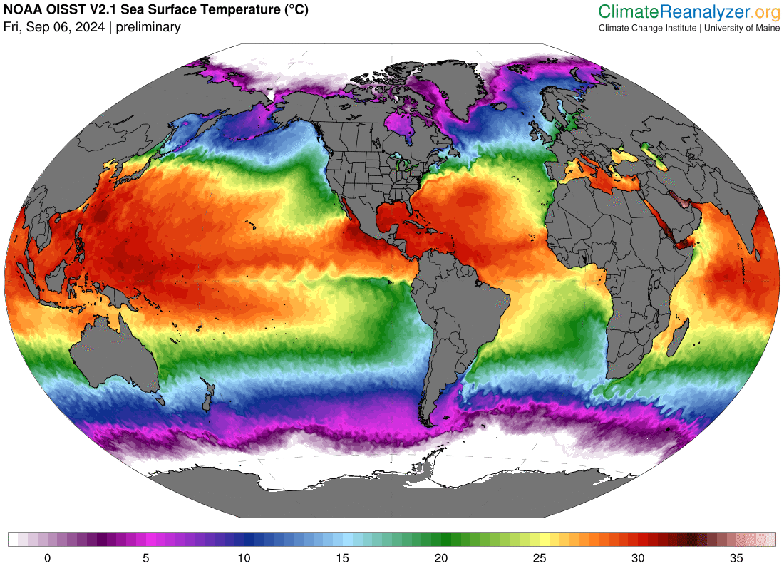
malaise
(275,214 posts)for starters - not good.
Let’s monitor Ted Cruz’s movements. 
orthoclad
(4,227 posts)and develop high winds, it will deposit a lot of moisture over a long period. Flooding will be a threat.
Yep, Cruz movements could be a reliable forecast method.