General Discussion
Related: Editorials & Other Articles, Issue Forums, Alliance Forums, Region ForumsEDIT: Two maps show why an Ohio CongressMAGAt shouldn't try to "Eastsplain" what went wrong in LA ....
Last edited Mon Jan 13, 2025, 11:36 AM - Edit history (2)
https://miro.medium.com/v2/resize:fit:640/format:webp/1*yPEl1n_Os9e67htGEipgaA.png (copy and paste the link to get rid of that annoying link-breaking *. Or see post #4 below by Celerity.)https://jimwfonseca.medium.com/the-one-minute-geographer-the-magical-meridian-the-20-inch-rainfall-line-f929aa4de734
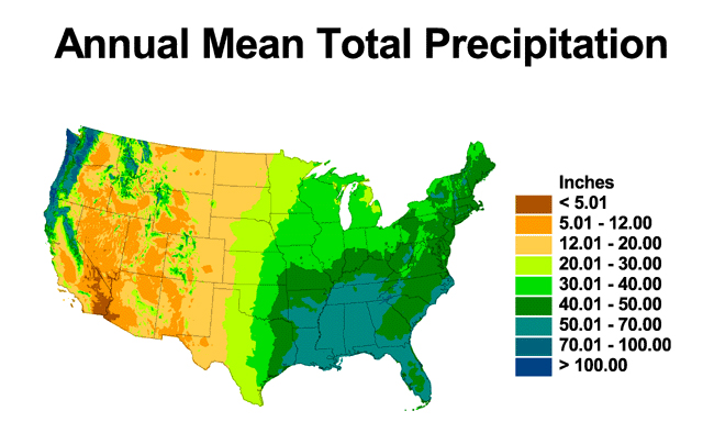
Farmers east of the Mississippi generally can do without irrigation, since they get > 30", and often 40" of precipitation; West of the Mississippi irrigation is pretty much essential. Most of CA gets < 20", and much of it < 12". That's why the hills are covered in chaparral, not forest.
Oh, and OH doesn't have any katabatic desert winds that I know of, so I sincerely doubt the gentleman from OH has any personal experience whatever of the situation he's criticizing.
 = new reply since forum marked as read
Highlight:
NoneDon't highlight anything
5 newestHighlight 5 most recent replies
= new reply since forum marked as read
Highlight:
NoneDon't highlight anything
5 newestHighlight 5 most recent replies
fargone
(274 posts)
eppur_se_muova
(38,127 posts)asterisk in the URL. Substituting HTML code doesn't do it.
fargone
(274 posts)It looked like the central flyway for bird migration with no legend. I will try later from my computer. Do I need to delete the asterisk?
eppur_se_muova
(38,127 posts)Maybe the phone OS can't handle it, I don't know. But from a PC, copying and pasting the whole link with the asterisk into your browser's URL field should work.
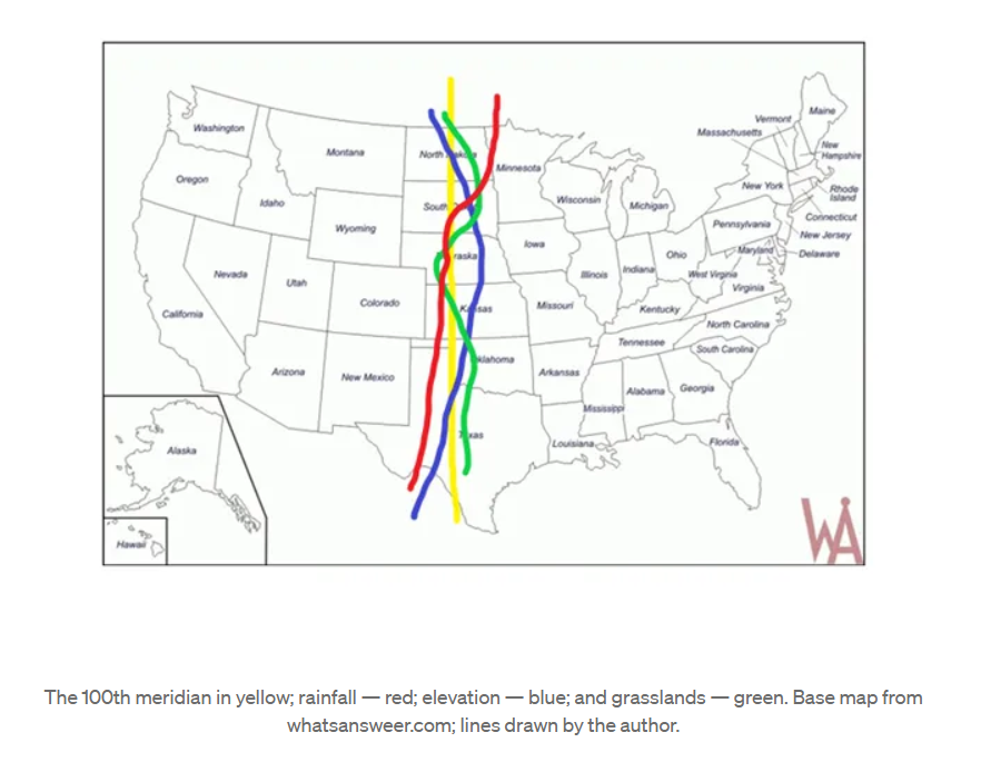
BTW, as the first map shows, there are a lot of important things that change sharply going from West to East, especially around the 100th meridian, so for all I know that may include bird migration routes -- it would be kind of surprising if it didn't. 
fargone
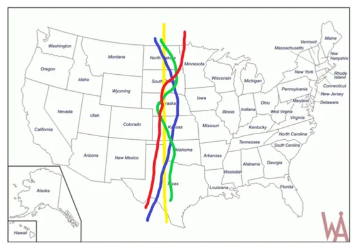
(274 posts)The one after copy-paste for me had three different color squiggly lines down the Great Plains but it had no title nor legend. I guesss the take away is that Ohio gets 3-4 times as much rain as LA.
eppur_se_muova
(38,127 posts)
Celerity
(47,668 posts)eppur_se_muova
(38,127 posts)The 100th meridian in yellow; rainfall — red; elevation — blue; and grasslands — green. Base map from whatsansweer.com; lines drawn by the author.
Celerity
(47,668 posts)