General Discussion
Related: Editorials & Other Articles, Issue Forums, Alliance Forums, Region ForumsI'm a bit confused...
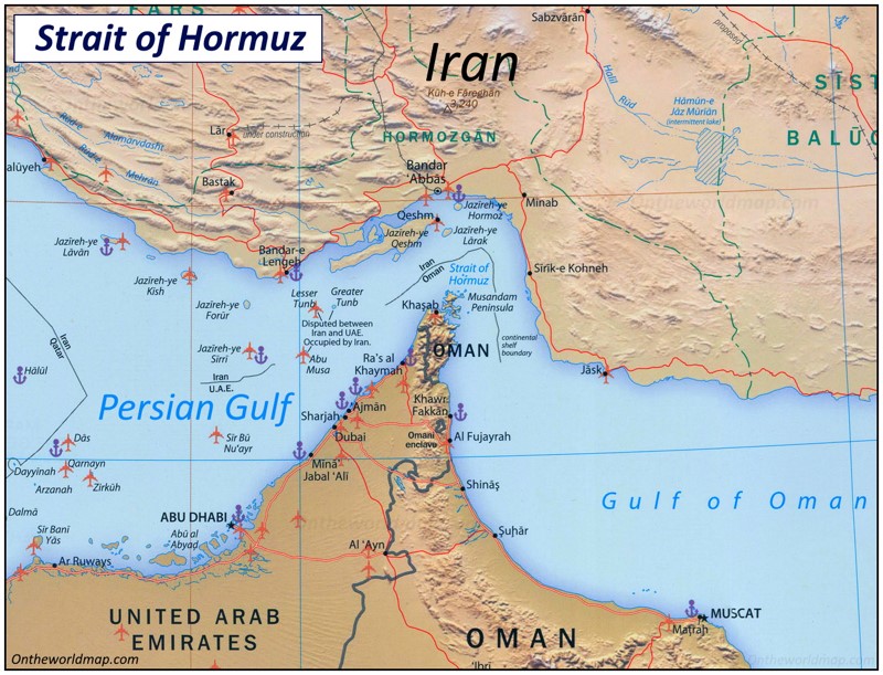
... the Strait of Hormuz is about 35 miles wide at its narrowest point, and the generally accepted limit of national territorial claims extends 12 nautical miles from shore. So what justification does Iran have to claim control of the entirety of the Strait? Couldn't Oman and United Arab Emirates make the same claim to the same waters?
And then there's to 200-mile limit. How do these two standards not conflict with one another?
Asking for 8 billion friends.
 = new reply since forum marked as read
Highlight:
NoneDon't highlight anything
5 newestHighlight 5 most recent replies
= new reply since forum marked as read
Highlight:
NoneDon't highlight anything
5 newestHighlight 5 most recent replies

Phoenix61
(18,898 posts)"At its narrowest point, the Strait is 21 miles wide, but the width of the shipping lane in either direction is only two miles, separated by a two-mile buffer zone. The Strait is deep and wide enough to handle the world's largest crude oil tankers, with about two-thirds of oil shipments carried by tankers in excess of 150,000 deadweight tons.to do with where is it navigable."
https://www.eia.gov/todayinenergy/detail.php?id=4430

Goonch
(5,650 posts)
GiqueCee
(4,823 posts)
canetoad
(21,077 posts)Is the narrow section, between the Persian Gulf and the Gulf of Oman. Iran is on one side and Oman is on the other. Iran's territory is the northern side - Oman to the south - the boundary is shown on the map. With the islands lying off the tip of Oman, it may make navigation difficult for large tankers, so they are forced to travel in Iran's waters.
GiqueCee
(4,823 posts)... to clarify this.