Study uses satellite imagery to identify over 1,000 Andean hillforts [View all]
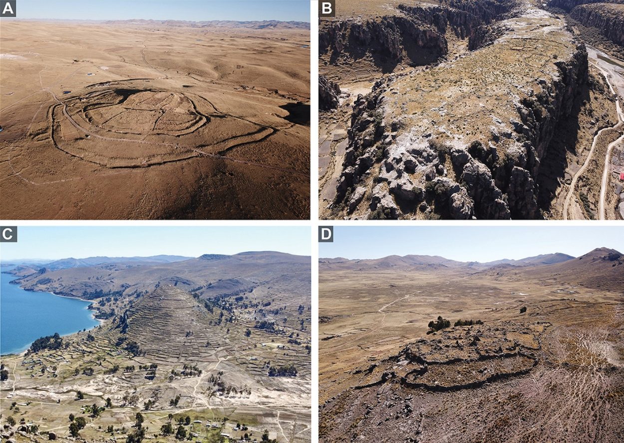
Image Credit : Antiquity
By:
Mark Milligan
Date:
February 28, 2024
A new study, published in the journal Antiquity, uses satellite imagery to survey hillforts known as pukaras in the Andean highlands.
Pukaras, meaning fortress in both Quechua and Aymara, were predominantly built on natural barriers such as hills and ridges during the Late Intermediate Period (AD 1000–1450). Previous studies suggest that the necessity for these fortified sites arose from social and environmental circumstances, precipitating a period of conflict during the LIP.
What remains unanswered is the full extent and intensity of pukaras construction and distribution, which in part is limited by the difficult terrain and large spatial coverage. In addition, details on their size, defensibility, and density of residential and non-residential occupation are vague due to a bias towards studying the large, densely occupied pukaras.o
The study authors used the results of three complementary systematic satellite survey projects, supplemented with targeted ground-checking and previous field research to reveal new insights into the pukaras phenomenon. The study area covered 151 103km2 of the southern Andean highlands and identified 1249 high-confidence pukaras in the satellite imagery.
According to the researchers: “Pukaras coded as non-residential are surprisingly frequent; they are present throughout the study region in only slightly smaller numbers (n = 567) than residential pukaras ( = 682).”
More:
https://www.heritagedaily.com/2024/02/study-uses-satellite-imagery-to-identify-over-1000-andean-hillforts/150852
 = new reply since forum marked as read